
Banburyshire Rambles Photo-Journal
Paul Mobbs’ photographic record of his walks around ‘Banburyshire’ and ‘The Irondowns’, and occasionally, as part of his work around Britain, the areas beyond.
![]()

‘Last Chance (HS)To See’ index
View Ordnance Survey map for this site
View HS2 route map for this site
‘Last Chance (HS)To See’ – Scene 13:
‘Radstone Hamlet, South’
A view approaching Radstone from The Worlidge
11th May 2018
© 2018-2021 Paul Mobbs; released under the  Creative Commons license.
Updated February 2021.
Leaving Brackley to walk to Radstone, avoiding the busy and narrow Radstone Road, the easiest route is via Halse Road and then The Worlidge green lane. That brings you to the point in the image above, looking into Radstone hamlet from the southwest.
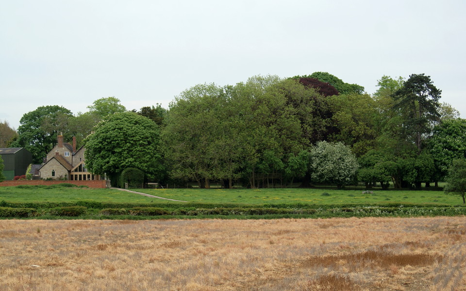
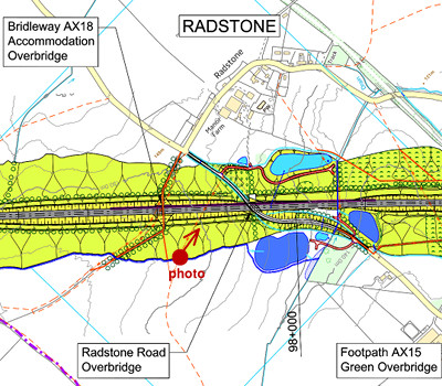
As HS2 passes Radstone the existing road to Brackley will be raised on a curving bridge almost five metres above its current level – just to the right of this picture. At this point, in the middle of the image, HS2 will enter a cutting that within a couple of hundred metres is roughly six metres deep. This bridleway will be diverted to the left to meet the bridleway from the northeast, crossing on an overbridge into Radstone.
Radstone was once a meeting point on a number of possible circular walks to the north and east of the hamlet. Many of those routes are now restricted by the A43 trunk road. The paths still exist; but you'd be putting yourself in extreme danger if you tried to cross the extremely busy high-speed dual carriageway.
The recent expansion of Brackley, along with the upgrading of the A43 a decade or so ago, has urbanized the area to the north of the town. HS2 extends that process further into the countryside. This not only increases the disruption of the natural environment; perhaps more critically, it reduces the ability of the population of the town to take part in low impact, ecotheraputic pursuits in the nearby countryside.