
Banburyshire Rambles Photo-Journal
Paul Mobbs’ photographic record of his walks around ‘Banburyshire’ and ‘The Irondowns’, and occasionally, as part of his work around Britain, the areas beyond.
![]()

‘Last Chance (HS)To See’ index
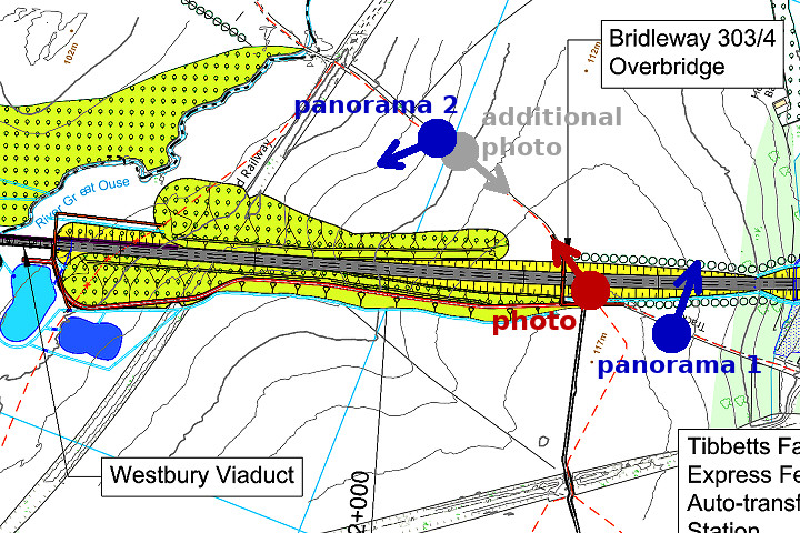
View Ordnance Survey map for this site
View HS2 route map for this site
‘Last Chance (HS)To See’ – Scene 24:
‘Mosseycorner Lane’
A beautiful green land is about to get a radical overhaul
11th June 2018
© 2018-2021 Paul Mobbs; released under the  Creative Commons license.
Updated February 2021.
On today's walk this green lane connecting Mixbury and Westbury was a 'must see'. It's a beautiful, undulating lane that crosses not only the Great Ouse, but also many notable landscape boundaries which affect the character of it. The coming of HS2 will significantly change the landscape as it cuts first below the lane, and then dominates the scene to the west as it crosses the Great Ouse valley on a viaduct.
It's also the boundary between the Oxfordshire parish of Mixbury, and the Buckinghamshire parish of Westbury; and between the slightly older geology to the north and west from that south and east – both of which give a slightly different visual and ecological character to the wider landscape either side.
It's quite pleasant actually, given that the etymological source of the village's name is the Saxon term 'mixen-burgh'; literally, "fortified dung-heap".
It is also crossed by two disused railways: The Banbury to Verney Junction Branch Line; and the Great Central Railway.
For these reasons this lane provides a very varied walking route, with great views up and down the Ouse valley, and a variety of plants and wildlife – despite the locally dominant arable agriculture (again, a feature of the different superficial geology here compared to that further up the line in Northamptonshire).
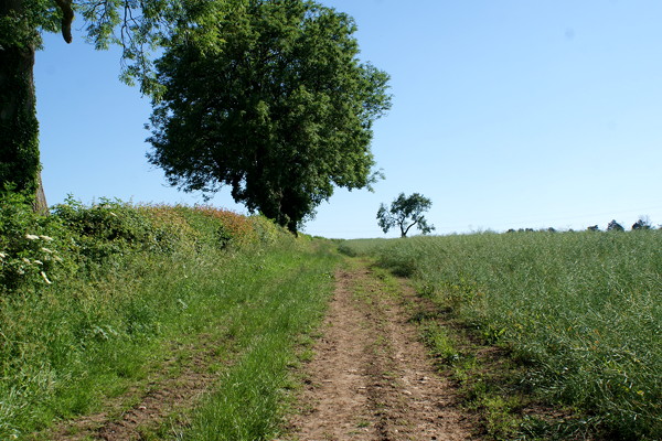
From Mixbury the lane drops steeply down, flanked on either side by a scrub thicket. This is artificial, engineered to get the lane onto a level course beneath the Great Central Railway – the now rusting iron-plate bridge still standing on its brick parapets. This regrading forms a long "green tunnel".
HS2 like to use the phrase 'green tunnel' a lot. In actual fact it's just a standard 'cut and cover' tunnel, engineered to save money rather than for environmental reasons, that can be landscaped when finished – though without deep rooting trees because they might damaged the engineered structure beneath.
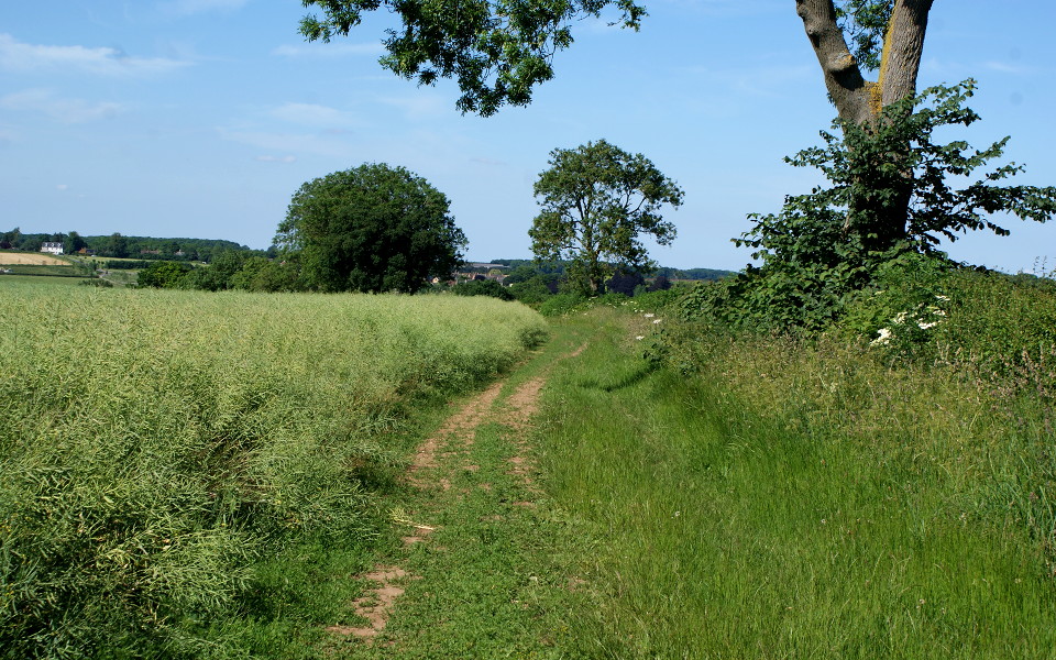
Beyond the railway the lane drops and crosses a small stream before rising to the top of a ridge that gives views up and down the Great Ouse valley, from Brackley almost into Buckingham.
Panorama north-east from the hill on Mosseycorner Lane
Use the slider to move the view from side to side
Load map of this location.
The main photo for this scene is taken from the edge of what will be the southern side of the overbridge crossing HS2. From there the lane drops towards the river – the view back to the top shown here on the left.
Beyond the crest of the ridge a thick line of mature trees can be seen running along the valley bottom, obscuring the river below. This is the course of the Banbury to Verney Junction branch.
Around half-way down the hill the view to the west, currently marked by a line of mature trees on the Great Central Line, will instead see an embankment emerge from the hillside, then transfer onto a viaduct 300 metres long, standing roughly 12 metres above the floor of the valley.
Progressing into Westbury that view of the viaduct and embankment will become more dominant, as the oblique angle of view becomes more perpendicular.
Panorama south-west from Mosseycorner Lane
Use the slider to move the view from side to side
Load map of this location.
As you cross the disused Banbury to Verney junction Branch, a short distance before the river, a bridleway forks-off to the west. The obstruction of the bridleway by overgrowth means that most now use the former trackbed as the path – until it meets the Great Central Railway around a mile or so to the west. This route too will by bisected, and diverted, around the base of the viaduct's southern end.
The isolation of Mosseycorner Lane, relative to the growing settlements and busy roads immediately around here, make it a seeming oasis of peace amidst the recent development boom associated with the improvement of A43 trunk road. Quite apart from the physical severance of the landscape and intrusion into the views along the Ouse valley, the degradation of this local theraputic resource is, for me, one of the greater impacts of HS2 on this tranquil cross-country route.