
Banburyshire Rambles Photo-Journal
Paul Mobbs’ photographic record of his walks around ‘Banburyshire’ and ‘The Irondowns’, and occasionally, as part of his work around Britain, the areas beyond.
![]()

‘Last Chance (HS)To See’ index
View Ordnance Survey map for this site
View HS2 route map for this site
‘Last Chance (HS)To See’ – Scene 26:
‘Turweston South’
Logging a more low intensity landscape change
11th June 2018
© 2018-2021 Paul Mobbs; released under the  Creative Commons license.
Updated February 2021.
Many of the sites selected for inclusion in this blog have been chosen because they represent a stark landscape intrusion. This site has been selected as a 'random' location that, theoretically, should present the opposite extreme; a barely perceptible intrusion.
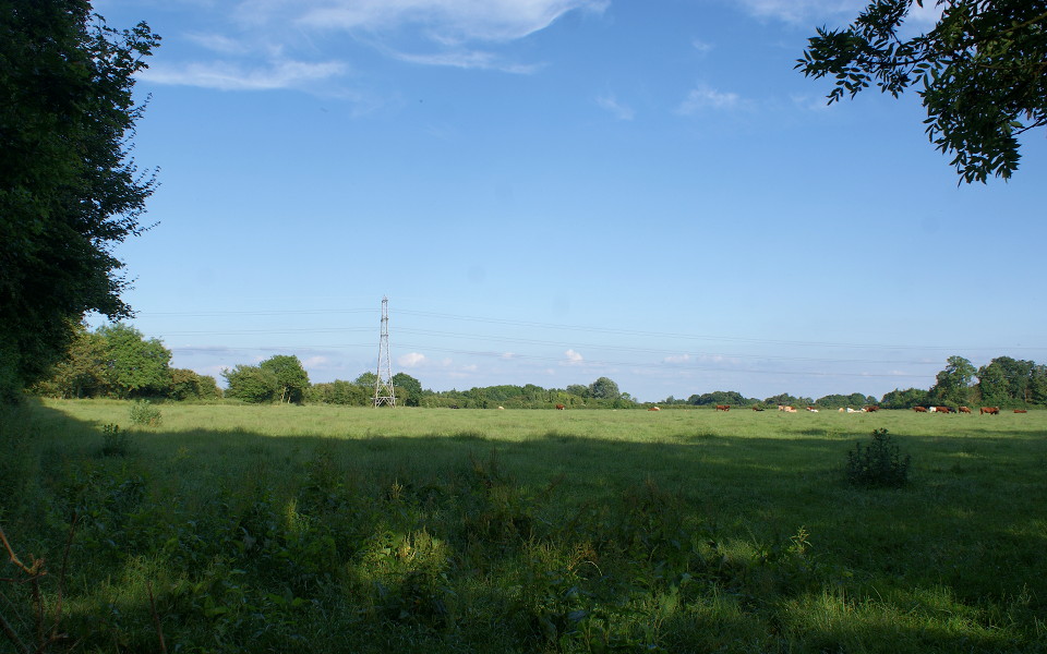
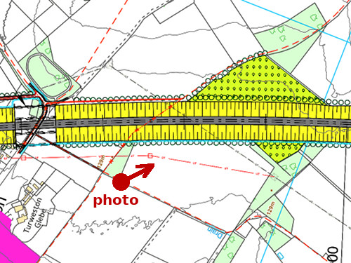
This bridleway represents a valuable link between the urban area and the countryside of the urban fringe – linking Turweston and Brackley to the green lanes extending to Westury and Evenley. In the above scene HS2 passes in a deep cutting, through the left hand side of the field and then behind the pylon in the centre.
Given the existing ground cover, and level topography, HS2 should have little impact here – other than noise, which will be reduced somewhat by the depth of the cutting and adjacent landscaping. For these reasons this site has been included to test the lower, rather than the higher, levels of its impact.